NASA’s Flow Country view shows why a treeless bog can hold so much carbon
An older Landsat image explains a much longer process: water slows decomposition, allowing peat to accumulate beneath the surface.
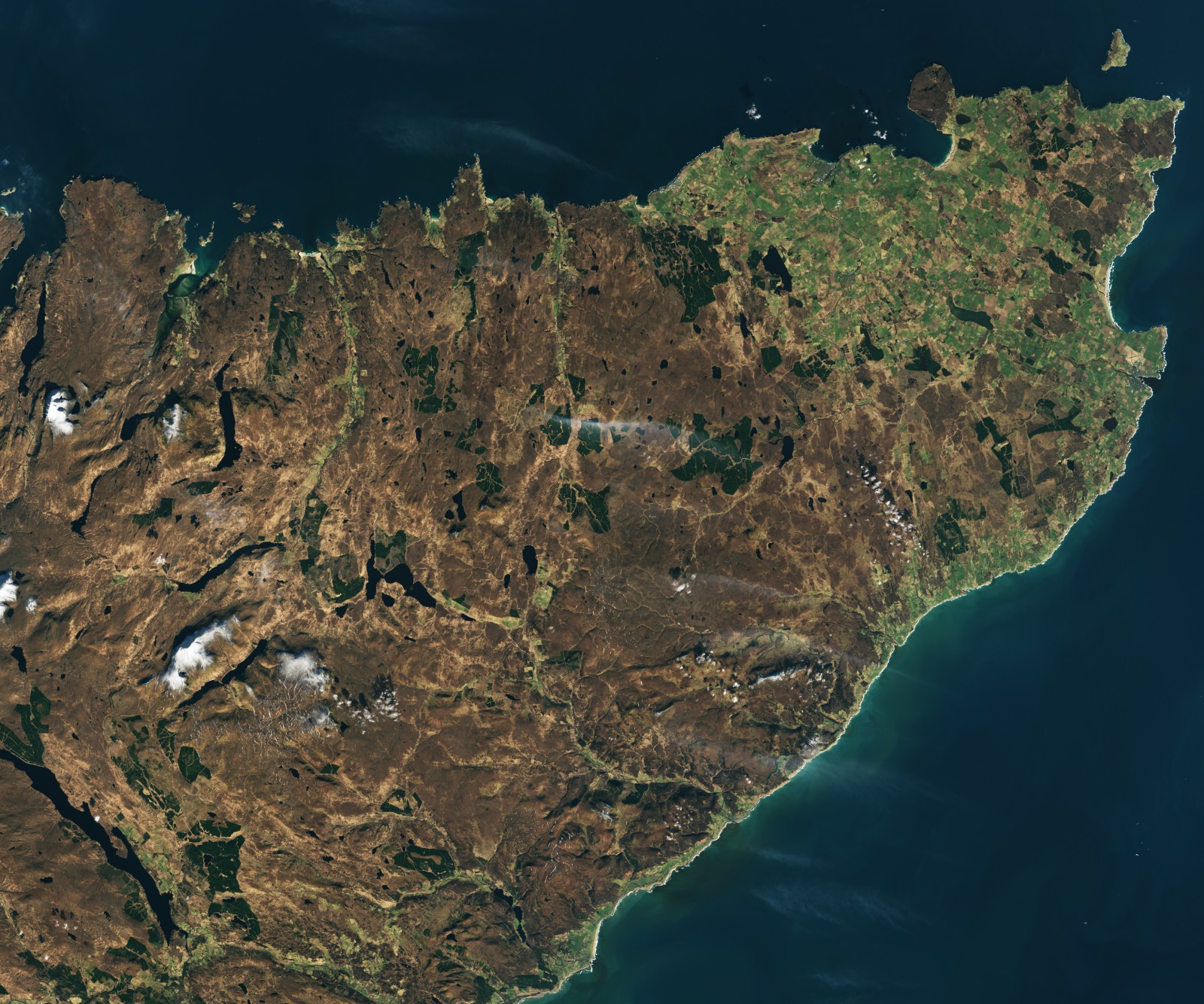
The dark, lake-speckled ground in NASA's latest Flow Country image looks relatively empty beside the fields and plantations around it. Much of what makes it valuable is below the surface: waterlogged peat has held on to plant carbon that would otherwise return to the atmosphere through decomposition.
NASA's November 12 Earth Observatory feature revisits northern Scotland's blanket bogs using a Landsat 8 image acquired on March 4, 2024. The distinction matters. This is a newly published explanation of an older observation, not a satellite photograph of this week's conditions.
Water slows the return journey
Plants take in carbon as they grow. When dead material decomposes, part of that carbon returns to the atmosphere. In a persistently waterlogged bog, the conditions limit the microbial breakdown of that material. The incomplete remains accumulate as peat instead of disappearing at the pace expected in a better-aerated environment.
That mechanism explains why a treeless landscape can hold a substantial carbon store. Looking only for tall, visibly abundant vegetation would overlook material built up beneath the living surface. The relevant timescale is also different: the present appearance sits above layers formed over many generations of plants.
NASA describes parts of the Flow Country where peat has accumulated for more than 9,000 years. A single growing season contributes to a much longer history. The striking feature is therefore not simply that the bog contains carbon, but that the wet conditions have allowed some of it to remain stored for millennia.
Read the patterns before assigning a number
In the image, dark brown areas dotted with lakes identify the bog landscape. Lighter green farmland appears around Thurso on the right, while darker geometric patches in the central area are conifer plantations. Those contrasts help show how different land uses occupy the same wider terrain.
They do not turn each colored patch into a direct carbon measurement. Estimating the underground store requires information such as peat depth, extent and material properties. The image can help map the setting; it cannot reveal the complete thickness and carbon content of every layer merely through its visible color.
This is a different question from the emissions estimates in our coverage of New Guinea's fires. There, the challenge was quantifying carbon being released during an event. Here, it is understanding a long-lived store and the conditions that maintain it. Both require the measurement to match the question, rather than asking a single picture to supply every answer.
Landsat makes the landscape comparable
The Landsat 8 mission collects observations across visible and infrared bands, providing a repeatable record for studying land cover and change. Its Operational Land Imager gives this scene its broad geographic context. A ground photograph could reveal the texture of moss and peat; the orbital view shows where bog, plantation and farmland meet.
Repeated observations can support comparisons, but this particular image remains one dated scene. Its spring timing is relevant to the wet surface and seasonal vegetation. Comparing it with another date would require attention to season and conditions before treating every difference in color as a lasting change.
The Landsat view of Chiricahua similarly used a wide perspective to explain a landscape's structure. In the Flow Country, that structure directs attention downward. The understated brown ground is not an absence of ecological activity: it is the surface of a carbon store whose persistence depends on the wet conditions that can make it look unremarkable from above.