Landsat shows the volcanic framework behind America’s newest national park
The July image, published this week, reveals rock and vegetation patterns rather than individual pinnacles. Chiricahua’s protection began a century ago.
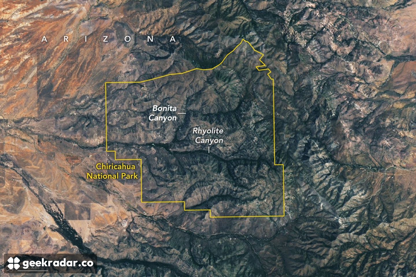
NASA's latest view of Chiricahua shows a landscape created by volcanic violence and refined by millions of years of erosion. The Arizona site became a US national park this month, but the satellite image offers a different kind of introduction: grey rock terrain crossed by green valleys, rather than the individual stone towers familiar from ground-level photographs.
The Earth Observatory image published on October 28 was acquired by Landsat 9 on July 2. It is a cloud-free view of the new park, not a photograph taken on the day its designation changed. The Department of the Interior announced that redesignation on October 21.
The towers began as a much more continuous deposit
Around 27 million years ago, eruptions spread ash and pumice across this part of southeastern Arizona. Hot flows produced welded rhyolitic tuff, a rock formed as volcanic material compacted and bonded. In places, deposits reached roughly 500 metres thick.
As the magma chamber emptied, the ground above collapsed into the Turkey Creek caldera, about 19 kilometres across. The dramatic pinnacles visible today were not each erupted as separate towers. Weathering and erosion subsequently worked on the larger rock mass, carving the canyons and formations that give the area its distinctive appearance.
That sequence matters when reading the scene. Volcanism supplied the material and broad structure; later processes separated and sculpted it. The resulting landscape records both creation and removal, across very different timescales.
What the satellite can resolve
Landsat's Operational Land Imager does not distinguish the individual spires in this view. It instead reveals their wider setting: the grey, eroding tuff and the greener drainage corridors of Rhyolite Canyon and Bonita Canyon.
This is a useful difference between satellite and ground photography. A close view can show how a boulder balances on a narrow column. The orbital view shows how exposed rock, water routes and plant cover fit into the surrounding terrain. Neither scale replaces the other.
A meeting place for ecosystems
Chiricahua sits where the Sonoran and Chihuahuan deserts, Rocky Mountains and Sierra Madre influence the landscape. Its varied habitats include desert vegetation, grassland, woodland and coniferous forest. NASA describes roughly a thousand plant species across the park's ecosystems.
The surrounding mountains are often called sky islands: higher, cooler terrain rises above the desert lowlands like islands above a sea. Elevation and the routes followed by water help explain why vegetation is concentrated unevenly across the image.
The site's protection dates back to its 1924 national-monument designation; the October change does not mark the discovery of an unrecognised landscape. What the new Landsat presentation adds is scale. Beyond the spectacular individual rocks lies a connected system of volcanic deposits, drainage and habitats, and the view from orbit makes those connections easier to see.