PACE is reading autumn through leaf chemistry, not just the color of a forest
NASA’s hyperspectral maps distinguish a pigment ratio from an ordinary photograph. Ground observations help explain what the signal means.
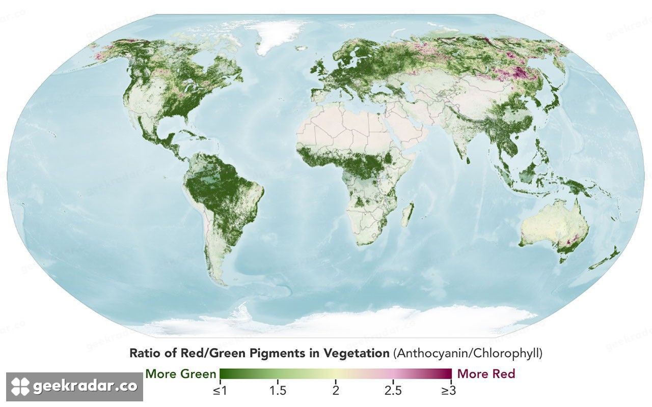
NASA's PACE satellite can follow autumn colour by measuring the changing balance of pigments in vegetation. New maps featured by Earth Observatory on October 26 show the progression of redness across parts of the Northern Hemisphere. They are measurements from late September and early October, not a live forecast of where leaves look best this afternoon.
The maps offer something more interesting than a scenic overview. PACE's Ocean Color Instrument observes hundreds of spectral bands, letting researchers examine signals associated with chlorophyll, carotenoids and anthocyanins. A sensor designed with ocean colour in its name can also reveal changes in plants on land.
Colour becomes a time series
A normal colour photograph combines a small number of broad channels. A hyperspectral instrument samples many narrower bands, creating more opportunities to distinguish materials and processes that look similar to the eye. PACE repeatedly observes large areas, so scientists can compare the signal across dates rather than relying on one attractive image.
The featured maps compare September 29–October 4 with October 5–11. NASA describes redness spreading toward lower latitudes while fading in some places that had already reached their strongest colour. The sequence matters: a single map cannot distinguish an area approaching its seasonal peak from one passing it.
The colours on the map represent a vegetation index, rather than the view a passenger would see from an aircraft. Higher values indicate more red relative to green in the measured signal. Interpreting that relationship requires knowing the plants, season and conditions beneath the satellite.
Why photographs from the ground still matter
NASA's scientists are asking people to contribute observations through the GLOBE phenology campaign. Ground photographs help connect a satellite signal with actual vegetation and distinguish possible causes. The useful observation need not be a spectacular forest: shrubs, grasses, crops and other plants also help.
This is an example of two kinds of evidence working at different scales. A satellite supplies repeated coverage that an individual observer cannot achieve. A person on the ground can show details the satellite's broad view cannot resolve. Neither replaces the other.
The PACE mission overview places the work within a broader programme studying oceans, aerosols and clouds. The autumn maps illustrate how the same observing capability can support additional questions about land vegetation.
A seasonal picture with a longer use
Researchers hope these time series can contribute to work on seasonal timing, the carbon cycle and vegetation stress. Those are research directions, not proof that the current maps already predict every drought or disease outbreak.
For a reader choosing a day out, a recent local report is still more useful than treating a multi-day global composite as a precise itinerary. For a scientist, the value is that the same colours can be followed again and again. Autumn ceases to be just a photograph of a brief display and becomes a record of when, where and how a living landscape changes.