Mount Kalaga gives GTA VI a different way to read distance
Wooded slopes, a road cutting and river-level views show how terrain can change exploration without a guessed map size.
In this guide
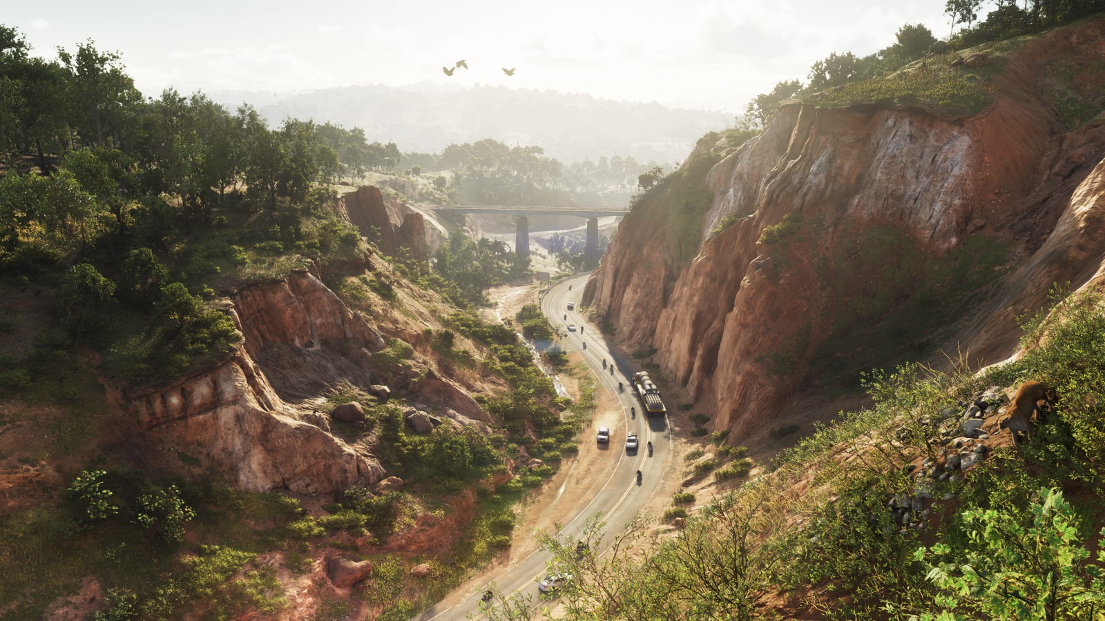
Mount Kalaga changes GTA VI's sense of distance by putting terrain between the player and the horizon. Rockstar's official images show wooded slopes, a deep road cutting and waterways beneath trees. Leonida's northern landscape is not simply Vice City with the buildings removed.
The official regional description places the national park near the state's northern border and identifies hunting, fishing and off-road trails among its attractions. The screenshot collection supplies the visual evidence examined here. This is a spoiler-free analysis of material already published for Grand Theft Auto VI, rather than a newly discovered location or a claim to have explored it.
Elevation changes what a road can show
The most revealing image looks along a road passing between substantial slopes. The route draws the eye into the distance, but the land limits what can be seen to either side. A city skyline offers landmarks above a street; this composition uses the shape of the ground itself to organize the view.
That creates a different impression of scale without requiring a larger map. A route can feel enclosed, exposed or distant because of elevation and sightlines, even when no numerical measurement is available. The image supports that visual observation. It cannot establish travel time, accessible boundaries or how much of the visible slope is traversable.
It is also a reminder that Leonida is fictional. A mountain or a road cutting in the game's presentation should not be treated as a survey of a particular real location. Rockstar is arranging a setting for an open-world game, and the official region names do not supply a one-to-one geographical key.
Wildlife is something to observe
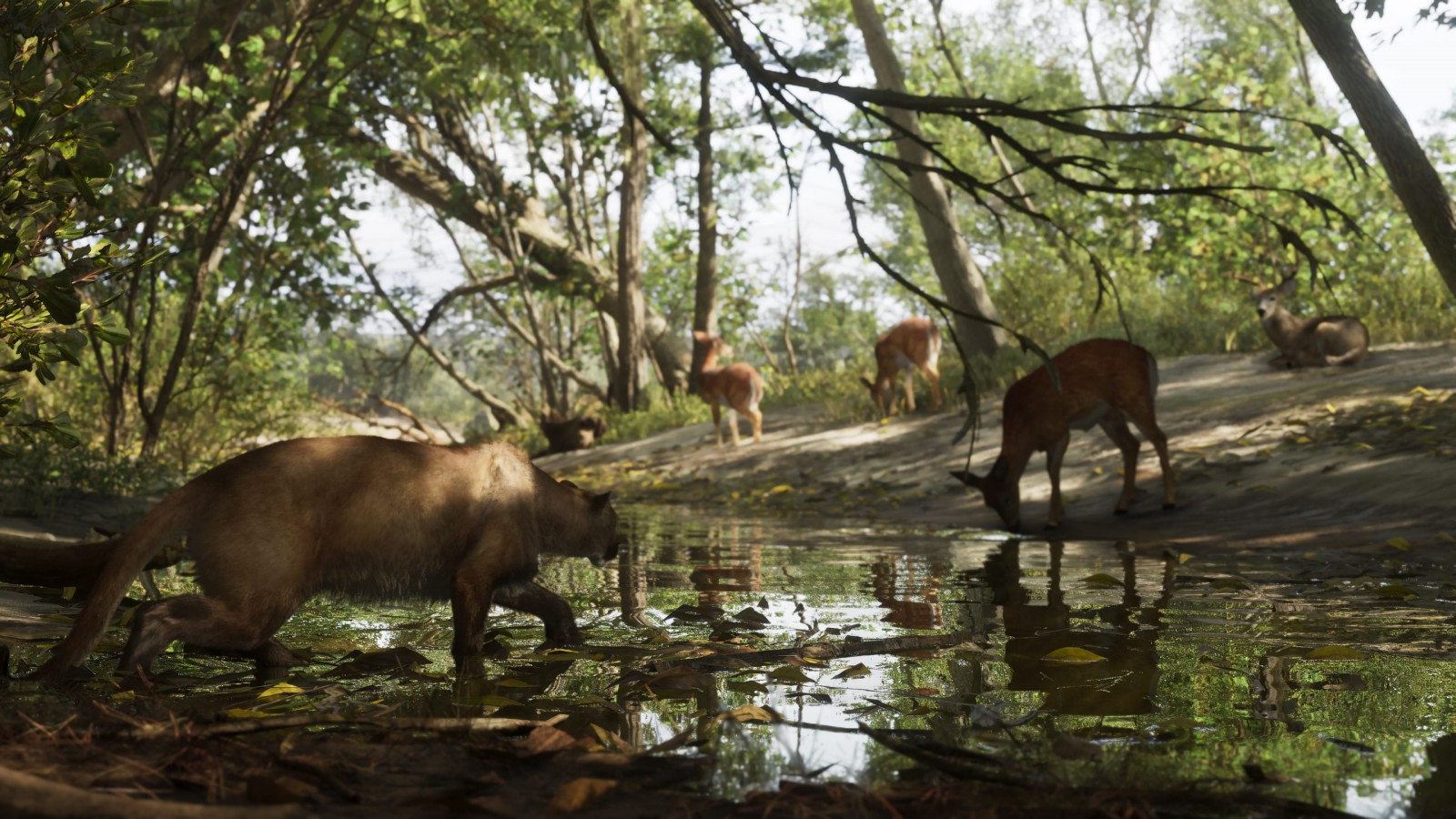
Another official scene shows deer beside water beneath a canopy of trees. The animals occupy a relatively small part of the frame, surrounded by vegetation and reflections. That composition makes looking closely part of the image's appeal, rather than presenting wildlife only as an immediate target.
There is a relevant mechanical connection in Rob Nelson's IGN interview: he describes studying animals as a way to collect information and engage with wildlife. It is a developer explanation of a game system, not proof that every animal in every screenshot can be studied in precisely the same way.
Keeping those boundaries matters. A picturesque wilderness image is easily turned into a list of imagined features. The material is already useful without doing that: it establishes a landscape where observation and movement can have a different rhythm from crossing a busy urban intersection.
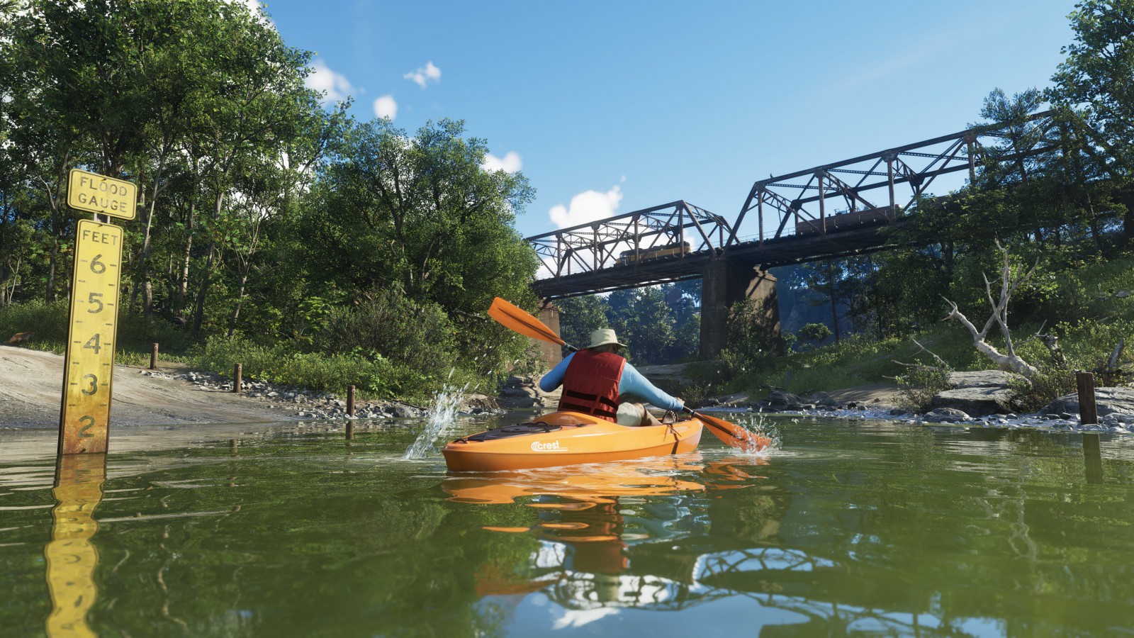
The river offers another level of the landscape
The kayaking image places the viewpoint near the water, with a bridge and dense vegetation above it. Compared with the elevated road view, the horizon becomes less important and nearby banks define the route. The same region can therefore present different scales of attention depending on where the player is looking from.
Our Grassrivers analysis examines how wetlands organize a scene through water and vegetation. Mount Kalaga adds a stronger relationship between high ground and lower routes. The comparison concerns the visible environments; it does not imply that their activities, controls or wildlife systems are identical.
The broader Leonida guide places the park among the state's other named regions. That context is useful because variety is not only a matter of changing colors or replacing buildings with trees. A convincing shift in terrain can change what is visible ahead, where the eye seeks a landmark and how a journey feels before any objective changes.
Mount Kalaga's promise is therefore more specific than having somewhere green to visit. Its official images offer a different way to read distance: sometimes from above a road, sometimes beneath a bridge, and sometimes by stopping long enough to notice what is standing at the water's edge.