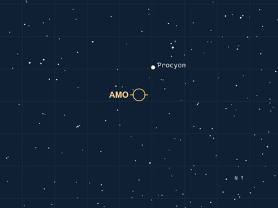
Cyclone Xavier’s eye was taking shape hours before NASA photographed it
A microwave scan picked out curved rainbands beneath the high clouds. Nine and a half hours later, Aqua caught a tight white spiral over the South Pacific. Xavier was still strengthening.
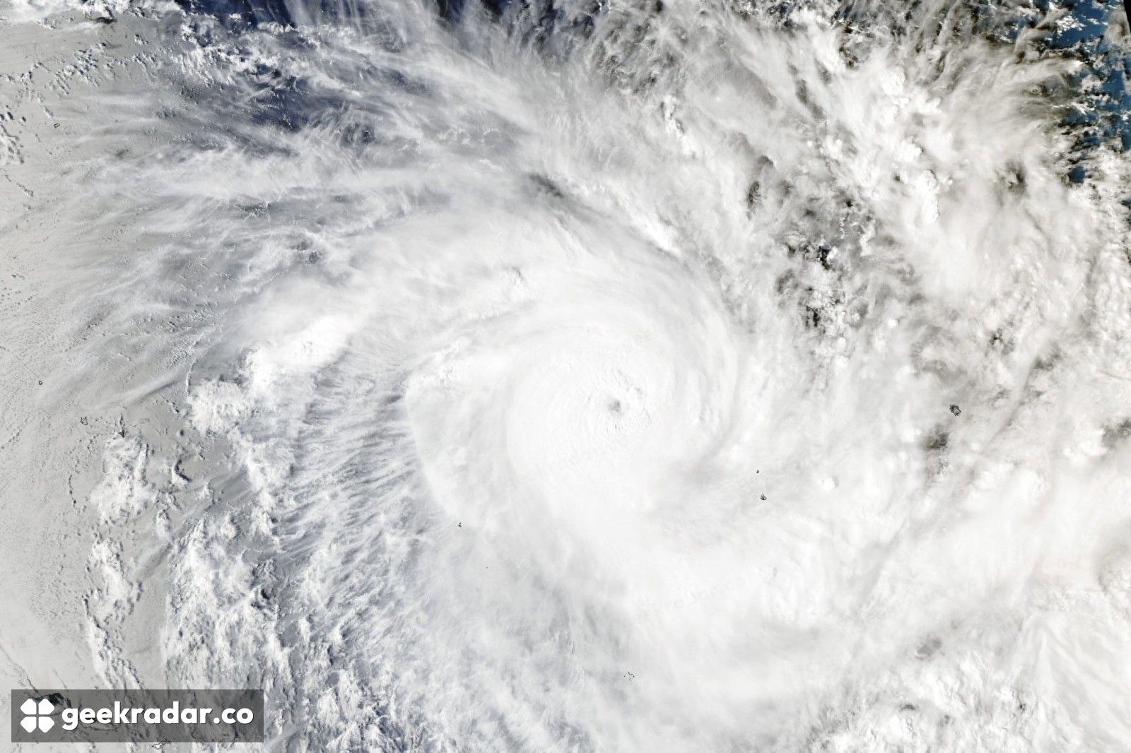
There’s a small dimple in the middle of the white spiral in NASA’s November 20 image of Cyclone Xavier. The Aqua satellite captured it at 02:53 UTC on November 17, when forecasters put the strongest winds at about 195 km/h. By then another satellite had already picked out the eye beneath the high clouds. And the fastest winds were still to come: NASA reports a peak of around 220 km/h later that day.
Aqua’s instrument, the Moderate Resolution Imaging Spectroradiometer (MODIS), gave a particularly clear view of the cloud tops. To see how that spiral came together, it helps to turn the clock back nine and a half hours and look at the same storm at a wavelength invisible to the eye.
Reading the colours beneath the cloud tops
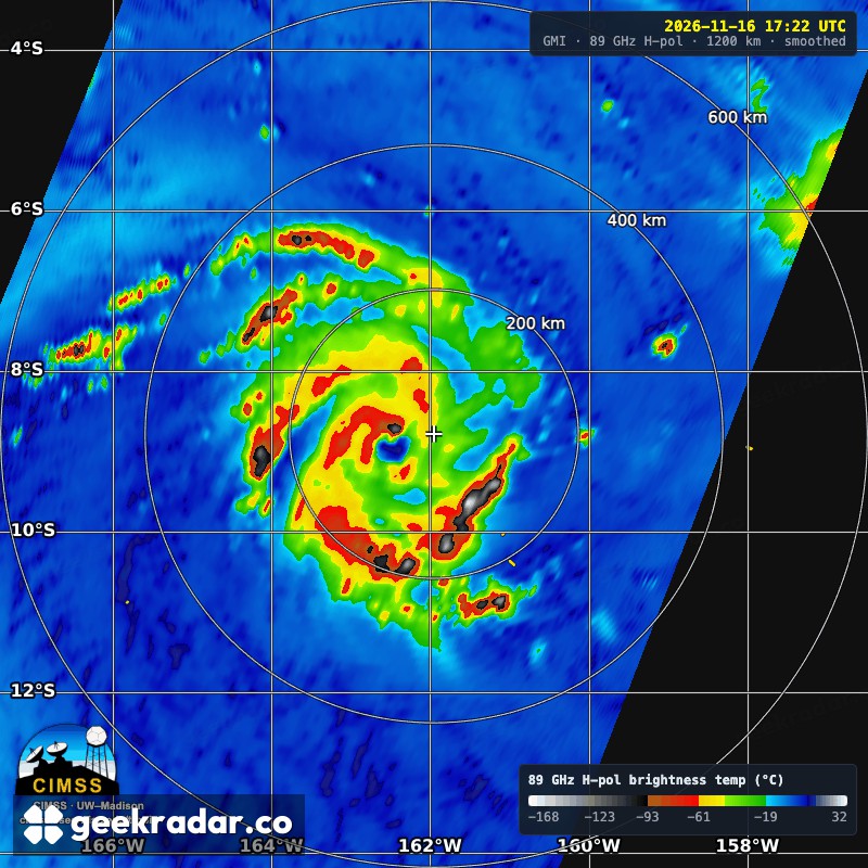
Start with the little blue patch just left of the cross in the microwave image. Follow the curved red band around its western side, then look farther out for the second, looser arc. Those bands are much easier to distinguish here than in the white canopy in Aqua’s picture. The GPM Microwave Imager recorded this pass at 17:22 UTC on November 16. Its colours represent the strength of the microwave signal at 89 gigahertz, expressed as a brightness temperature. The scale at bottom right is in degrees Celsius. It gives neither the air temperature someone on an island would feel nor a wind speed.
The University of Wisconsin–Madison satellite team’s sequence makes the still frame more revealing. On November 14 the microwave observations showed a roughly curved mass of storm activity. By the final passes on November 16, distinct rainbands wrapped around a well-defined eye. Thin, high ice clouds can spread across the centre and mask that structure in visible light. Switching instruments let the researchers follow the organisation of the rain below. As with water stored in a mountain snowpack, what looks clearest in a satellite photograph can be a different quantity from the one you want to measure.
What the wind estimate leaves out
The Fiji Meteorological Service’s November 20 bulletin classified Xavier as Category 1 at 18:00 UTC. In the northern Cook Islands, a more immediate measure of the storm’s impact was the electricity available to run a freezer. Manihiki resident Jean Marie Williams told Pacific Media Network on November 19 that the island’s main diesel generator had been out of service for over a year. Heavy cloud and rain had cut the solar power available to charge the batteries, and emergency generators were helping keep food cold. The wind could fall well below its peak while families still waited for enough sunlight to get through the night.