NASA’s mangrove comparison shows a rebound that a global total cannot fully explain
Newly highlighted Landsat images illustrate older research on recovery, while forest maturity and local losses remain consequential.
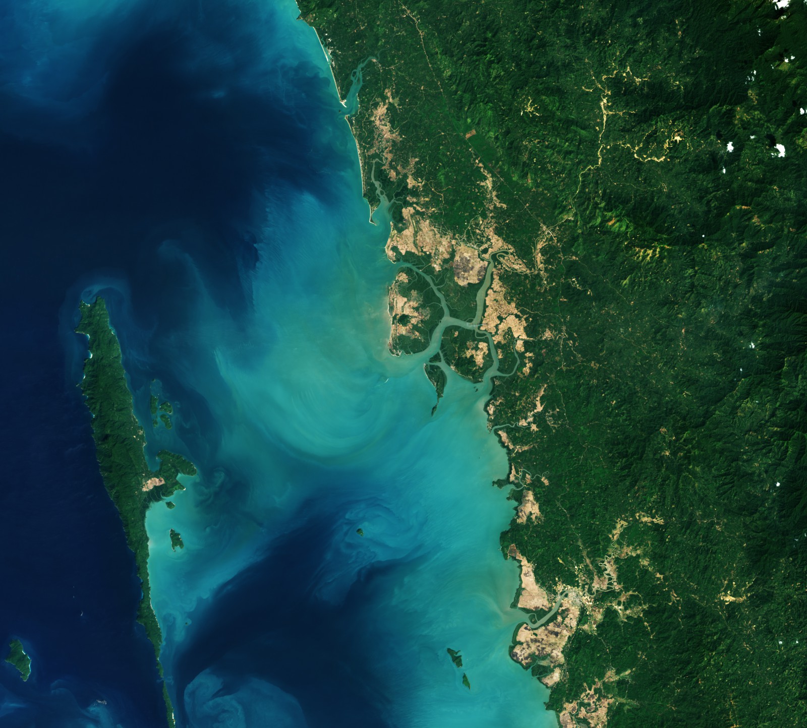
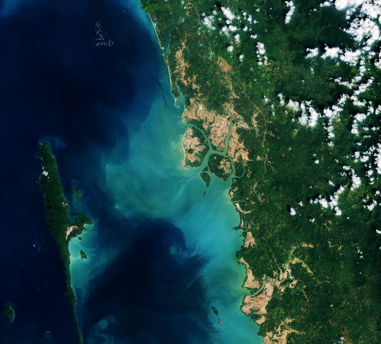
NASA's latest mangrove image pair shows a coast becoming greener where some fields once stood. The November 13 Earth Observatory feature compares Landsat observations of Myanmar's Myeik District from February 2010 and February 2026, illustrating a broader finding: after decades of decline, mangrove area has been increasing globally in the satellite record examined by researchers.
The dates describe different things. These are not images taken this week, and the underlying study is not a newly announced November result. Tulane University reported the research in June. NASA's new contribution is an accessible visual explanation of that longer-term change.
A global gain can coexist with serious local losses
The Tulane-led study uses four decades of satellite observations. The university reports that mangroves lost nearly 2,900 square kilometers between the 1980s and 2010, before subsequent expansion and regrowth offset much of that decline. By 2023, the net loss over the full period was about 1%.
That is a much more encouraging trajectory than uninterrupted contraction. It is not the same as saying every coastline has recovered, or that the same forests have returned to the same places. A global total combines gains and losses across regions. The improvement in the sum can hide a damaging local trend.
Nor is area the only useful measure. The study also examines canopy condition, with closed-canopy forests expanding and degradation slowing. A mapped patch of vegetation and a mature, dense ecosystem do not provide identical information about ecological function.
New ground and abandoned ground create opportunities
The researchers describe several routes to recovery. Sediment deposited along coasts and river deltas can create new mudflats that mangroves colonize. Elsewhere, trees return to abandoned aquaculture areas or other ground where previous land use has ended. Restoration and protection can help, but growth is not limited to places where people have planted seedlings.
That matters when interpreting a successful conservation story. Counting only planting projects can miss natural regeneration; counting all new vegetation as the result of a particular project can overstate what that project achieved. The mechanisms need to be distinguished before assigning credit or deciding which intervention to repeat.
The images from Myanmar make the land-use relationship visible at a particular location. They are an illustration of local change, not a substitute for the global analysis. Two selected scenes cannot independently establish the worldwide balance of losses and gains.
Expansion is not immunity from climate extremes
Tulane also describes warming allowing mangroves to expand into areas that were previously less suitable. Yet its account notes a sharp decline in Texas after the extreme freeze of 2021. A longer-term trend toward warmer conditions does not remove the possibility of a damaging cold event.
Young forests also need time. The researchers caution that newly established mangroves do not immediately provide all the ecological benefits of mature systems. Treating a newly green pixel as a complete replacement for an old forest would compress that development into a misleading instant.
This is a recurring challenge in satellite science: the visible surface is evidence to interpret, not a complete ecological account. A useful environmental image needs the processes and timescales behind it, rather than a verdict based on color alone.
The encouraging result is that decline is not the only possible trajectory. The practical implication is to protect the forests that remain and the conditions that let regeneration continue. A net global rebound is a reason to take those conditions seriously, not a license to clear a mature forest because trees are growing somewhere else.