Common Space wants aid groups to help choose where a satellite looks next
Satellogic will build the first spacecraft for a planned mid-2027 launch. The promise for responders is a say in future observations as well as permission to reuse the pictures.
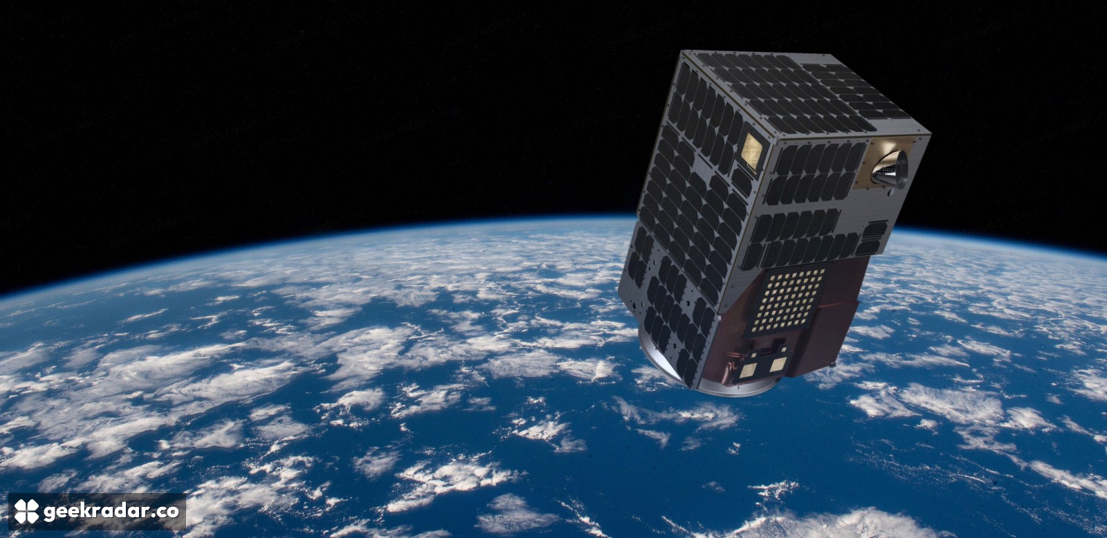
After a river breaks its banks, an aid team can download yesterday’s satellite image and still have no way to ask for one tomorrow. Common Space wants to give public-interest groups a say in that second decision. On November 19 the nonprofit chose Satellogic to build its first Earth-observation spacecraft, a NewSat Mark V targeted for launch in mid-2027. Satellogic will also manage the launch, ground systems and operations. Satellogic’s mission announcement
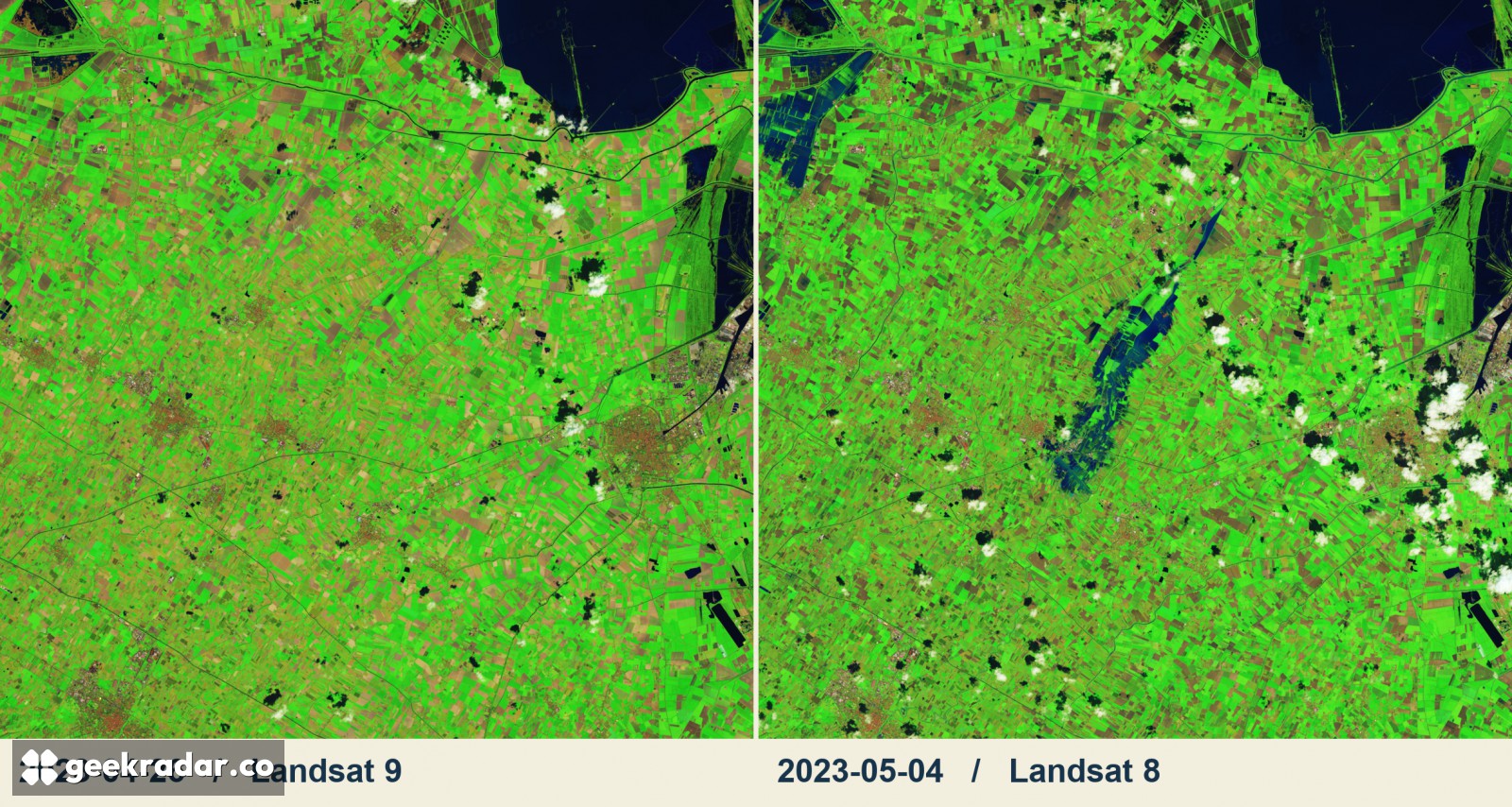
A second look at the same river
Two Landsat images of the Lamone River show what the timing of an observation can change. In one, taken on April 26, 2023, a patchwork of fields fills the frame. In the next, taken on May 4 after heavy rain, dark water extends into farmland beside the river. The image pair uses false color: vegetation appears green and water dark blue. The earlier frame supplies the baseline that makes the later one easier to interpret. Both belong to the existing Landsat record. NASA Earth Observatory’s images and account of the flood
A team choosing where to send people next might need another view of a particular stretch of river. Searching an archive works only if a spacecraft has already collected the right scene. Tasking means requesting a location and time window for a future observation. That request must fit the spacecraft’s orbit, and clouds can obscure the ground when an optical instrument passes overhead. A licence governs what people can do with an image once it exists. It cannot get the satellite there a day sooner.
Common Space proposes to collect imagery according to community input and release it under an open licence. Private-sector members would help pay for the shared infrastructure. An aid group and a researcher could then use the same acquisition for different purposes. The announcement leaves a harder operational question open: how will the community choose between two urgent requests when the spacecraft can satisfy only one?
What the first spacecraft can collect
The joint announcement specifies four bands: red, green, blue and near-infrared. The manufacturer gives a native resolution of 70 centimetres and a swath of 6.5 kilometres. Think of the swath as the width of the strip photographed during a pass. A detailed strip through a floodplain answers a different question from a broad view of an entire river basin.
Daily high-resolution coverage of priority areas is a goal for six satellites by 2030. Common Space is raising philanthropic funding for that constellation. Neither the number of spacecraft nor the proposed frequency describes a service aid groups can order today. Space.com’s launch reporting
As NASA’s Terra archive shows, an image can keep answering questions long after the instrument stops taking pictures. The test for Common Space comes earlier in that chain. When the river changes course again, can the people working along its banks get a useful stretch of it onto the next collection schedule?