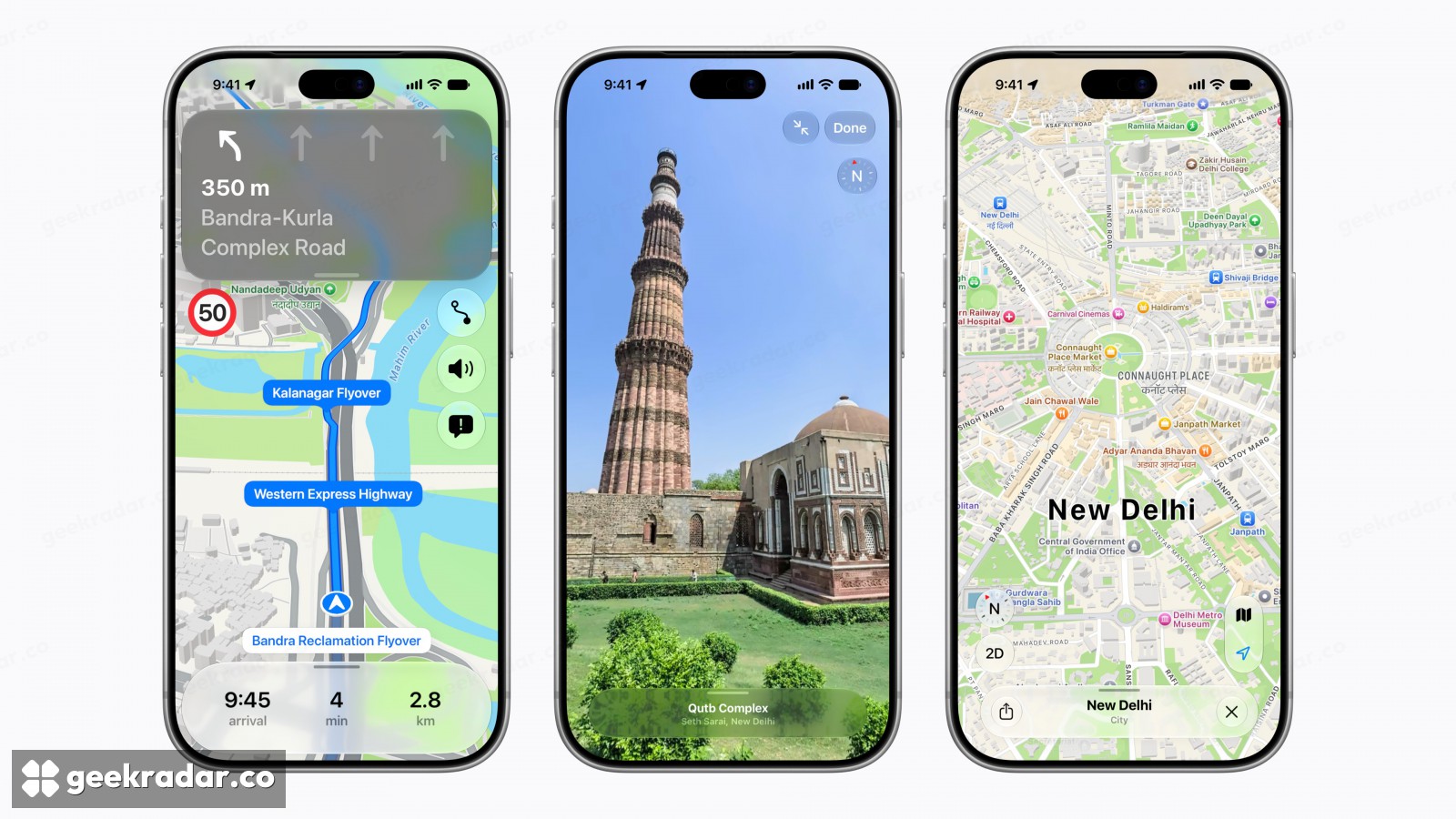
Apple Maps in India can now give you a turn you can recognise
A petrol station can mark a turn, and a Delhi station can carry two names on screen. Apple’s rebuilt map uses the cues people can actually see from the road.
A petrol station can be a better instruction than a street name. If the road has no name, or the driver cannot spot a sign before the junction, announcing the name more clearly does little good. In the new map of India that Apple introduced on November 18, spoken directions can use features such as petrol stations and pillars to mark a turn. That changes what the passenger listening to the phone can look for through the windscreen.
Apple calls the feature enhanced Natural Language Guidance. The distinction is easiest to hear in its own example: “Turn right after the petrol pump.” The word after does some of the work here. Someone who can see both the station and the turn can match the order of the instruction to the road in front of them. A distance countdown alone asks the driver to judge where the next few dozen metres will end.
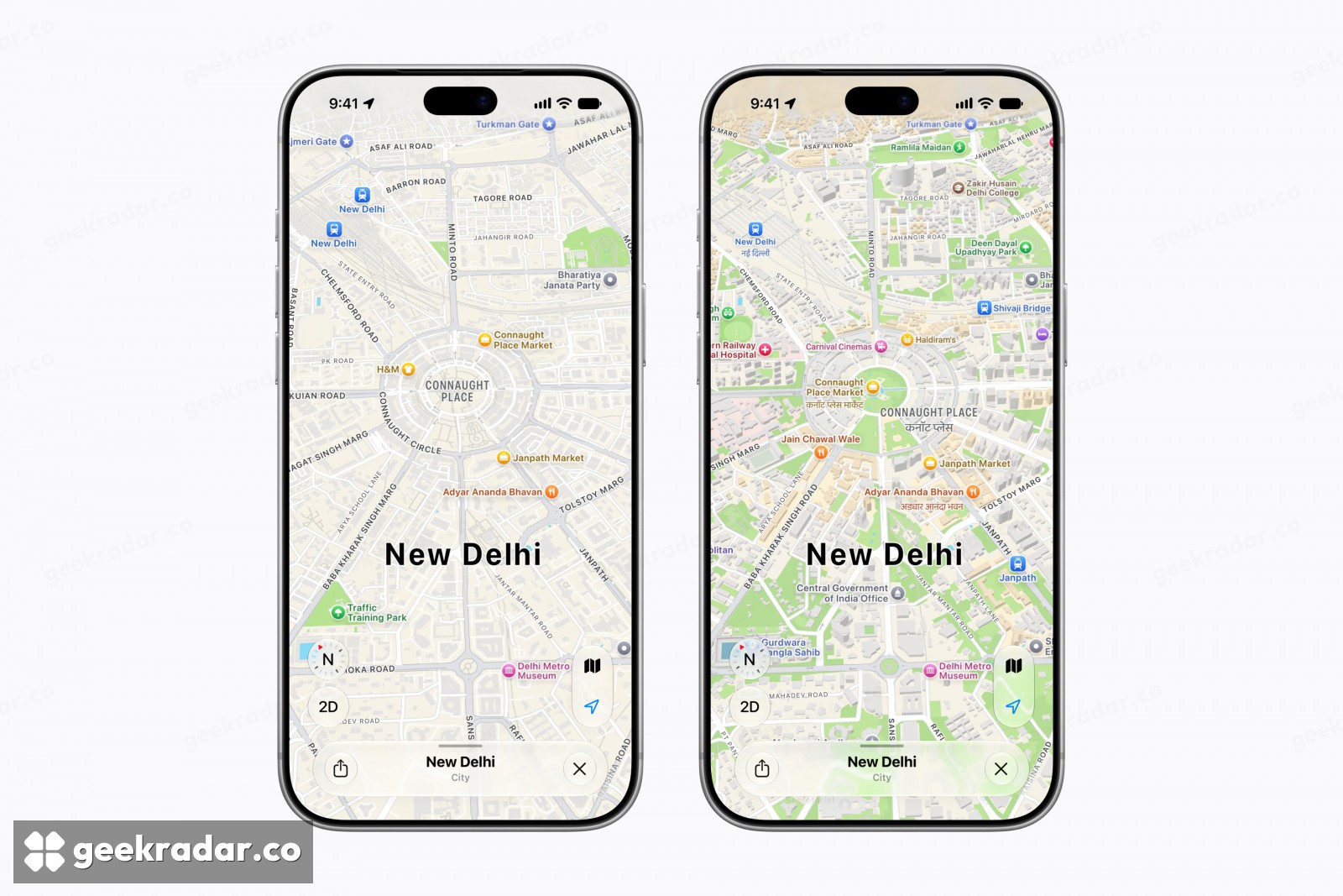
One place, two ways to read its name
Look at the ring of streets around Connaught Place in Apple’s New Delhi comparison. On the newer map, the outlines of individual buildings make it easier to pick out a block. Zoom in and there is a second change: names of places can appear in two languages. That is useful even when the traveller already knows the name of the destination. The problem on arrival can be recognising it on a station sign.
The pair of languages depends on the device setting and the area on screen. Apple gives a revealing example. Leave the device in English and look at Delhi: the map can pair English with Hindi. Move the map to Mumbai without changing the phone setting and the local language becomes Marathi. The Indian Express reported on the rollout alongside the new lane guidance and street imagery. Apple specifies iOS 27.2 or later on iPhone for the bilingual labels and enhanced spoken guidance. The iPhone 18 Pro in its illustrations is the device used to show them.
A street you can visit before you get there
Look Around lets someone abroad inspect covered Indian streets. Apple's Bengaluru example places the viewer on Dr BR Ambedkar Road: you can look across the pavement at a building you might later recognise in person. Augmented-reality walking directions serve a different purpose. On location, the iPhone uses a scan of the surrounding buildings to establish where the walker is and place the next direction in the scene. A street panorama is useful before departure; that camera-based fix needs the surroundings themselves.
The coverage also varies by mode. Apple lists public transport planning in Ahmedabad, Bengaluru, Chennai, Delhi, Hyderabad, Kolkata, Mumbai and Pune, as well as on Indian Railways. A nationwide map update does not automatically give every town the same transit data.
A trip planner such as Google’s multi-day Ask Maps can help decide which stop belongs next. Apple’s smallest change tackles the remaining few seconds at the junction: once the petrol station comes into view, the person in the passenger seat has something useful to point to.